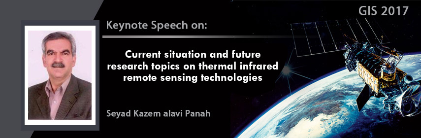
Sessions/Tracks
Track 1: GIS
Geographic information system (GIS) is a system designed to capture, store, manipulate, analyse, manage, and present all types of spatial or geographical data. The acronym GIS is sometimes used for geographical information science or geospatial information studies to refer to the academic discipline or career of working with geographic information systems and is a large domain within the broader academic discipline of Geo informatics. GIS is a broad term that can refer to a number of different technologies, processes, and methods. It is attached to many operations and has many applications related to engineering, planning, management, transport/logistics, insurance, telecommunications, and business.
Related GIS Conferences | Remote Sensing Conferences
4th International Conference on Geology and Geoscience April 27-28, 2017 Dubai, UAE; 5th Global Geologists Annual Meeting July 6-8, 2017 Bangkok, Thailand; 6th International Conference on Earth Science and Climate Change September 18-19, 2017 Macau, Hong Kong; 4th international conference on Green Energy & Expo Nov 06-08, 2017 USA; Annual Congress on Soil Sciences Dec 4-5, 2017 Madrid, Spain; 3rd International Conference on Renewable Energy Technologies (ICRET 2017), Scopus Bangkok, Thailand, January 22nd , 2017; ASPRS Annual Conference - Imaging & Geospatial Technology Forum (IGTF) March 11-17, 2017, MD, U.S.A; IEEE International Conference on Big Data Analysis (ICBDA 2017) - IEEE Xplore and Ei Beijing, China March 10th, 2017; GEO Business 2017 March 23-24, 2017, London, UK; International Conference on Geosciences October 06-07, 2016, Orlando, United States.
Associations:
American Society for Photogrammetry & Remote Sensing, Cartography and geographic information society (CAGIS), ESRI conservation program, National centre for geographic information and analysis (NCGIA), National centre for geographic information and analysis (NCGIA), European (Association of Remote Sensing Laboratories EARSeL), Germany, Remote Sensing and Photogrammetry Society (RSPSoc), UK
Track 2: Geoinformatics
Geographical and earth sciences are depending on increasingly on digital spatial data attained from smart phones, social media API’s and remotely sensed images, analysed by geographical information systems (GIS) and cloud-based applications, disseminated through complex infrastructures, and visualised by and for an ever-increasing variety of users. The technologies supporting these processes are at the essential of geoinformatics
Technological skills alone, however, are not sufficient for establishments involved in the production and management of such geo-information. Owing to the rapid changes and developments in geo-information acquisition, investigation and dissemination, these organizations require scientific staff that can keep pace with and validate the relevancy of developments and the quality of the - nowadays - Big Geo Data, processes and geo-information. To tackle the challenges, you will learn to design and develop algorithms, models, and tools that can process the geo-spatial data into truthful, actionable information.
Related GIS Conferences | Remote Sensing Conferences
4th International Conference on Geology and Geoscience April 27-28, 2017 Dubai, UAE; 5th Global Geologists Annual Meeting July 6-8, 2017 Bangkok, Thailand; 6th International Conference on Earth Science and Climate Change September 18-19, 2017 Macau, Hong Kong; 4th international conference on Green Energy & Expo Nov 06-08, 2017 USA; Annual Congress on Soil Sciences Dec 4-5, 2017 Madrid, Spain; 3rd International Conference on Renewable Energy Technologies (ICRET 2017), Scopus Bangkok, Thailand, January 22nd , 2017; ASPRS Annual Conference - Imaging & Geospatial Technology Forum (IGTF) March 11-17, 2017, MD, U.S.A; IEEE International Conference on Big Data Analysis (ICBDA 2017) - IEEE Xplore and Ei Beijing, China March 10th, 2017; GEO Business 2017 March 23-24, 2017, London, UK; International Conference on Geosciences October 06-07, 2016, Orlando, United States.
Associations:
American Society for Photogrammetry & Remote Sensing, Cartography and geographic information society (CAGIS), ESRI conservation program, National centre for geographic information and analysis (NCGIA), National centre for geographic information and analysis (NCGIA), European (Association of Remote Sensing Laboratories EARSeL), Germany, Remote Sensing and Photogrammetry Society (RSPSoc), UK
Track 3: Remote Sensing
Remote sensing is the process where the Remote sensors collect data by detecting the energy that is reflected from earth. These sensors can be on satellites or mounted on aircrafts. The electromagnetic radiation is normally used as an information carrier in remote sensing.. Remote sensors gather information by measuring the electromagnetic radiation that is reflected, emitted and absorbed by objects in various spectral regions, from gamma-rays to radio waves. To measure this radiation, both active and passive remote sensors are used. Passive remote sensors record natural sensors that is reflected or emitted from the earth surface. The most common source of detection is sunlight. Active sensors use internal stimuli to collect data about earth.
Remote sensing methods are used to gain a better understanding of the earth and its functions. A Global Earth Observation System of Systems (GEOSS) is being developed to connect earth observation systems around the world. A comprehensive and coordinated system of earth observations could lead to better management of environmental data and could fulfil numerous societal benefits.
Related GIS Conferences | Remote Sensing Conferences
4th International Conference on Geology and Geoscience April 27-28, 2017 Dubai, UAE; 5th Global Geologists Annual Meeting July 6-8, 2017 Bangkok, Thailand; 6th International Conference on Earth Science and Climate Change September 18-19, 2017 Macau, Hong Kong; 4th international conference on Green Energy & Expo Nov 06-08, 2017 USA; Annual Congress on Soil Sciences Dec 4-5, 2017 Madrid, Spain; 3rd International Conference on Renewable Energy Technologies (ICRET 2017), Scopus Bangkok, Thailand, January 22nd , 2017; ASPRS Annual Conference - Imaging & Geospatial Technology Forum (IGTF) March 11-17, 2017, MD, U.S.A; IEEE International Conference on Big Data Analysis (ICBDA 2017) - IEEE Xplore and Ei Beijing, China March 10th, 2017; GEO Business 2017 March 23-24, 2017, London, UK; International Conference on Geosciences October 06-07, 2016, Orlando, United States.
Associations:
American Society for Photogrammetry & Remote Sensing, Cartography and geographic information society (CAGIS), ESRI conservation program, National centre for geographic information and analysis (NCGIA), National centre for geographic information and analysis (NCGIA), European (Association of Remote Sensing Laboratories EARSeL), Germany, Remote Sensing and Photogrammetry Society (RSPSoc), UK
Track 4: Remote Sensing Applications
Remote sensing application is a software application that procedures remote sensing data. Remote sensing applications are comparable to graphics software, but they enable generating geographic information from satellite and airborne sensor data. Remote sensing data help in regular management of water resources, finding different types of bioresources, plays potential role in both rapid & comprehensive EIA, detection and monitoring of the water pollution, acquiring information regarding offshore engineering activities, fisheries surveillance, ocean features, coastal regions and storm forecast operations, identifying Potential Fishing Zones (PFZ), and Continuous monitoring of land use or land cover with remote sensing imageries have been of huge use in providing information on temporal and spatial changes in area under aquaculture, mangrove areas, coral reef mapping & other land use patterns. Remote sensing applications read specialized file formats that contain sensor image data, georeferencing information & sensor metadata. Some of the more popular remote sensing file formats include: GeoTIFF, NITF, JPEG 2000, ECW (file format), MrSID, HDF, and NetCDF.
Related GIS Conferences | Remote Sensing Conferences
4th International Conference on Geology and Geoscience April 27-28, 2017 Dubai, UAE; 5th Global Geologists Annual Meeting July 6-8, 2017 Bangkok, Thailand; 6th International Conference on Earth Science and Climate Change September 18-19, 2017 Macau, Hong Kong; 4th international conference on Green Energy & Expo Nov 06-08, 2017 USA; Annual Congress on Soil Sciences Dec 4-5, 2017 Madrid, Spain; 3rd International Conference on Renewable Energy Technologies (ICRET 2017), Scopus Bangkok, Thailand, January 22nd , 2017; ASPRS Annual Conference - Imaging & Geospatial Technology Forum (IGTF) March 11-17, 2017, MD, U.S.A; IEEE International Conference on Big Data Analysis (ICBDA 2017) - IEEE Xplore and Ei Beijing, China March 10th, 2017; GEO Business 2017 March 23-24, 2017, London, UK; International Conference on Geosciences October 06-07, 2016, Orlando, United States.
Associations:
American Society for Photogrammetry & Remote Sensing, Cartography and geographic information society (CAGIS), ESRI conservation program, National centre for geographic information and analysis (NCGIA), National centre for geographic information and analysis (NCGIA), European (Association of Remote Sensing Laboratories EARSeL), Germany, Remote Sensing and Photogrammetry Society (RSPSoc), UK
Track 5: Geodynamics
Geodynamics is the study of motion and change on Earth. It provides the quantitative foundation for the theory of Plate Tectonics, Volcanism, the chemistry of lava and volcanic rocks, gravity and geomagnetic anomalies as well as seismic investigations into the structure of the mantle. The basic organizing paradigm for our understanding of the solid earth. Geodynamics specializes in high-end Geographic Information Systems, offering a broad spectrum of GIS services from simple data conversion to complex hydrographical data processing, data modelling and analysis.
Related GIS Conferences | Remote Sensing Conferences
4th International Conference on Geology and Geoscience April 27-28, 2017 Dubai, UAE; 5th Global Geologists Annual Meeting July 6-8, 2017 Bangkok, Thailand; 6th International Conference on Earth Science and Climate Change September 18-19, 2017 Macau, Hong Kong; 4th international conference on Green Energy & Expo Nov 06-08, 2017 USA; Annual Congress on Soil Sciences Dec 4-5, 2017 Madrid, Spain; 3rd International Conference on Renewable Energy Technologies (ICRET 2017), Scopus Bangkok, Thailand, January 22nd , 2017; ASPRS Annual Conference - Imaging & Geospatial Technology Forum (IGTF) March 11-17, 2017, MD, U.S.A; IEEE International Conference on Big Data Analysis (ICBDA 2017) - IEEE Xplore and Ei Beijing, China March 10th, 2017; GEO Business 2017 March 23-24, 2017, London, UK; International Conference on Geosciences October 06-07, 2016, Orlando, United States.
Associations:
American Society for Photogrammetry & Remote Sensing, Cartography and geographic information society (CAGIS), ESRI conservation program, National centre for geographic information and analysis (NCGIA), National centre for geographic information and analysis (NCGIA), European (Association of Remote Sensing Laboratories EARSeL), Germany, Remote Sensing and Photogrammetry Society (RSPSoc), UK
Track 6: GIS in Mapping
Geographic Information Systems that offers a radically different way in which we produce and use the maps required to manage our communities and industries. A geographic information system (GIS) is a computer system for capturing, storing, checking, and displaying data related to positions on Earth’s surface. GIS can show many different kinds of data on one map. Once the desired data has been entered into a GIS system they can produce a wide variety of individual maps, depending on which data layers are included. GIS maps can also use to show data about density and number. GIS` technology combines database, mapping and statistical methods to integrate georeferenced data into visual displays where the relationships, patterns and trends in the data can be more easily identified.
Related GIS Conferences | Remote Sensing Conferences
4th International Conference on Geology and Geoscience April 27-28, 2017 Dubai, UAE; 5th Global Geologists Annual Meeting July 6-8, 2017 Bangkok, Thailand; 6th International Conference on Earth Science and Climate Change September 18-19, 2017 Macau, Hong Kong; 4th international conference on Green Energy & Expo Nov 06-08, 2017 USA; Annual Congress on Soil Sciences Dec 4-5, 2017 Madrid, Spain; 3rd International Conference on Renewable Energy Technologies (ICRET 2017), Scopus Bangkok, Thailand, January 22nd , 2017; ASPRS Annual Conference - Imaging & Geospatial Technology Forum (IGTF) March 11-17, 2017, MD, U.S.A; IEEE International Conference on Big Data Analysis (ICBDA 2017) - IEEE Xplore and Ei Beijing, China March 10th, 2017; GEO Business 2017 March 23-24, 2017, London, UK; International Conference on Geosciences October 06-07, 2016, Orlando, United States.
Associations:
American Society for Photogrammetry & Remote Sensing, Cartography and geographic information society (CAGIS), ESRI conservation program, National centre for geographic information and analysis (NCGIA), National centre for geographic information and analysis (NCGIA), European (Association of Remote Sensing Laboratories EARSeL), Germany, Remote Sensing and Photogrammetry Society (RSPSoc), UK
Track 7: GPS & Photogrammetry
The Global Positioning System is known as Navstar GPS or simply Navstar is a global navigation satellite system (GNSS) that delivers geolocation and time information to a GPS receiver in all climate and weather conditions, anywhere on or near the Earth where there is an unhindered line of sight to four or more GPS satellites. The GPS system operates independently of any telephonic or internet reception, though these technologies can improve the usefulness of the GPS positioning information. The GPS system provides critical positioning capabilities to military, civil, and commercial users across the world.
Photogrammetry is the science of making measurements from photographs, particularly for recovering the exact positions of surface points. It may also be used to recover the motion pathways of selected reference points on any moving object, on its components, and in the immediately adjacent environment. Photogrammetric analysis may be applied to one photograph, or may use high-speed photography and remote sensing to detect, measure and record complex 2-D and 3-D motion fields (sonar, radar, lidar, etc.). Photogrammetry feeds dimensions from remote sensing and the results of imagery analysis into computational models in an attempt to successively estimate, with increasing accuracy, the actual, 3-D relative motions within the researched field.
Related GIS Conferences | Remote Sensing Conferences
4th International Conference on Geology and Geoscience April 27-28, 2017 Dubai, UAE; 5th Global Geologists Annual Meeting July 6-8, 2017 Bangkok, Thailand; 6th International Conference on Earth Science and Climate Change September 18-19, 2017 Macau, Hong Kong; 4th international conference on Green Energy & Expo Nov 06-08, 2017 USA; Annual Congress on Soil Sciences Dec 4-5, 2017 Madrid, Spain; 3rd International Conference on Renewable Energy Technologies (ICRET 2017), Scopus Bangkok, Thailand, January 22nd , 2017; ASPRS Annual Conference - Imaging & Geospatial Technology Forum (IGTF) March 11-17, 2017, MD, U.S.A; IEEE International Conference on Big Data Analysis (ICBDA 2017) - IEEE Xplore and Ei Beijing, China March 10th, 2017; GEO Business 2017 March 23-24, 2017, London, UK; International Conference on Geosciences October 06-07, 2016, Orlando, United States.
Associations:
American Society for Photogrammetry & Remote Sensing, Cartography and geographic information society (CAGIS), ESRI conservation program, National centre for geographic information and analysis (NCGIA), National centre for geographic information and analysis (NCGIA), European (Association of Remote Sensing Laboratories EARSeL), Germany, Remote Sensing and Photogrammetry Society (RSPSoc), UK
Track 8: GIS & RS in Renewable Energy
A geographical information system (GIS) and Remote Sensing is a powerful, quickly developing technology that is making a major influence on renewable energy industries. GIS & RS integrates hardware, software and data for bagging, managing, studying and displaying all forms of geographically referenced information. With GIS, companies could view, understand, question, understand and envisage data in numerous ways that reveal relationships, designs and trends in the form of maps, globes, reports and charts. It is considered the go-to expertise for making the best choices about siting. That is because of the lavishness of information it provides about local land use, population density, proximity to the grid, existing infrastructure, natural resource extraction, environmental assessments and more. It helps the energy company understand what is happening, plus what is expected to happen, in a specific geographical space.
Related GIS Conferences | Remote Sensing Conferences
4th International Conference on Geology and Geoscience April 27-28, 2017 Dubai, UAE; 5th Global Geologists Annual Meeting July 6-8, 2017 Bangkok, Thailand; 6th International Conference on Earth Science and Climate Change September 18-19, 2017 Macau, Hong Kong; 4th international conference on Green Energy & Expo Nov 06-08, 2017 USA; Annual Congress on Soil Sciences Dec 4-5, 2017 Madrid, Spain; 3rd International Conference on Renewable Energy Technologies (ICRET 2017), Scopus Bangkok, Thailand, January 22nd , 2017; ASPRS Annual Conference - Imaging & Geospatial Technology Forum (IGTF) March 11-17, 2017, MD, U.S.A; IEEE International Conference on Big Data Analysis (ICBDA 2017) - IEEE Xplore and Ei Beijing, China March 10th, 2017; GEO Business 2017 March 23-24, 2017, London, UK; International Conference on Geosciences October 06-07, 2016, Orlando, United States.
Associations:
American Society for Photogrammetry & Remote Sensing, Cartography and geographic information society (CAGIS), ESRI conservation program, National centre for geographic information and analysis (NCGIA), National centre for geographic information and analysis (NCGIA), European (Association of Remote Sensing Laboratories EARSeL), Germany, Remote Sensing and Photogrammetry Society (RSPSoc), UK
Track 9: GIS & RS in Climate Change
Satellite remote sensing is providing major advances in understanding the climate system and its changes, by quantifying procedures and spatio-temporal states of the atmosphere, land and oceans., The climate system that have not been detected by climate models and conventional observations, the spatial pattern of sea-level rise and the cooling effects of increased stratospheric aerosols. New insights are made possible by the unparalleled global- and fine-scale spatial coverage of satellite observations. Nevertheless, the short duration of observation series and their uncertainties still pose challenges for taking the robust long-term trends of many climate variables. Climate change is an unparalleled threat to the food security of hundreds of millions of people who depend on small-scale agriculture for their livings. Climate change disturbs agriculture and food security, and likewise, agriculture and natural resource management disturb the climate system.
The use of GIS for climate change would likely become more dominant in the transportation sector if the frequency and intensity of extreme weather events increases thus influencing transportation agencies to pursue additional capabilities to spatially analyze or predict the extent and potential damage caused by these events. In the short term, using GIS to support climate change adaptation plans will be more extensive as transportation agencies will need to develop strategies to strategies to mitigate or avoid the anticipated impacts of climate change.
Related GIS Conferences | Remote Sensing Conferences
4th International Conference on Geology and Geoscience April 27-28, 2017 Dubai, UAE; 5th Global Geologists Annual Meeting July 6-8, 2017 Bangkok, Thailand; 6th International Conference on Earth Science and Climate Change September 18-19, 2017 Macau, Hong Kong; 4th international conference on Green Energy & Expo Nov 06-08, 2017 USA; Annual Congress on Soil Sciences Dec 4-5, 2017 Madrid, Spain; 3rd International Conference on Renewable Energy Technologies (ICRET 2017), Scopus Bangkok, Thailand, January 22nd , 2017; ASPRS Annual Conference - Imaging & Geospatial Technology Forum (IGTF) March 11-17, 2017, MD, U.S.A; IEEE International Conference on Big Data Analysis (ICBDA 2017) - IEEE Xplore and Ei Beijing, China March 10th, 2017; GEO Business 2017 March 23-24, 2017, London, UK; International Conference on Geosciences October 06-07, 2016, Orlando, United States.
Associations:
American Society for Photogrammetry & Remote Sensing, Cartography and geographic information society (CAGIS), ESRI conservation program, National centre for geographic information and analysis (NCGIA), National centre for geographic information and analysis (NCGIA), European (Association of Remote Sensing Laboratories EARSeL), Germany, Remote Sensing and Photogrammetry Society (RSPSoc), UK
Track 10: GIS in Disaster management
Geographic Information Systems (GIS) and remote sensing (RS) are very useful and effective tools in disaster management. Various disasters like earthquakes, landslides, floods, fires, tsunamis, volcanic eruptions and cyclones are natural hazards that kill lots of people and destroy property and infrastructures every year. Landslides are the most regular geological vulnerabilities in mountain regions. Remotely sensed data can be used very efficiently to assess severity and impact of damage due to these disasters. In the disaster relief phase, GIS, grouped with global positioning system (GPS) is extremely useful in search and rescue operations in areas that have been devastated and where it is difficult to find one’s bearings. Disaster mapping is the drawing of areas that have been through excessive natural or man-made troubles to the normal environment where there is a loss of life, property and national infrastructures.
Related GIS Conferences | Remote Sensing Conferences
4th International Conference on Geology and Geoscience April 27-28, 2017 Dubai, UAE; 5th Global Geologists Annual Meeting July 6-8, 2017 Bangkok, Thailand; 6th International Conference on Earth Science and Climate Change September 18-19, 2017 Macau, Hong Kong; 4th international conference on Green Energy & Expo Nov 06-08, 2017 USA; Annual Congress on Soil Sciences Dec 4-5, 2017 Madrid, Spain; 3rd International Conference on Renewable Energy Technologies (ICRET 2017), Scopus Bangkok, Thailand, January 22nd , 2017; ASPRS Annual Conference - Imaging & Geospatial Technology Forum (IGTF) March 11-17, 2017, MD, U.S.A; IEEE International Conference on Big Data Analysis (ICBDA 2017) - IEEE Xplore and Ei Beijing, China March 10th, 2017; GEO Business 2017 March 23-24, 2017, London, UK; International Conference on Geosciences October 06-07, 2016, Orlando, United States.
Associations:
American Society for Photogrammetry & Remote Sensing, Cartography and geographic information society (CAGIS), ESRI conservation program, National centre for geographic information and analysis (NCGIA), National centre for geographic information and analysis (NCGIA), European (Association of Remote Sensing Laboratories EARSeL), Germany, Remote Sensing and Photogrammetry Society (RSPSoc), UK
Track 11: Seismology and Geodesy
Seismology is the study of earthquakes and seismic waves. Seismic waves are the waves of energy caused by the sudden breaking of rock within the earth or an explosion. They are the energy that travels through the earth and is recorded on seismographs. GIS helps to manage the impact of Earthquakes and other disasters by assessing risk and hazard locations in relation to populations, property, and natural resources, Integrating data and enabling understanding of the scope of an emergency to manage an incident and identifying staging area locations, operational branches and divisions, and other important incident management needs. Geodesy is the science of accurately measuring and understanding three fundamental properties of the earth its geometric shape, its orientation in space, and its gravity field as well as the changes of these properties with time. In relation to GIS, geodesy provides the fundamental framework for accurate positions on or near the Earth’s surface.
Related GIS Conferences | Remote Sensing Conferences
4th International Conference on Geology and Geoscience April 27-28, 2017 Dubai, UAE; 5th Global Geologists Annual Meeting July 6-8, 2017 Bangkok, Thailand; 6th International Conference on Earth Science and Climate Change September 18-19, 2017 Macau, Hong Kong; 4th international conference on Green Energy & Expo Nov 06-08, 2017 USA; Annual Congress on Soil Sciences Dec 4-5, 2017 Madrid, Spain; 3rd International Conference on Renewable Energy Technologies (ICRET 2017), Scopus Bangkok, Thailand, January 22nd , 2017; ASPRS Annual Conference - Imaging & Geospatial Technology Forum (IGTF) March 11-17, 2017, MD, U.S.A; IEEE International Conference on Big Data Analysis (ICBDA 2017) - IEEE Xplore and Ei Beijing, China March 10th, 2017; GEO Business 2017 March 23-24, 2017, London, UK; International Conference on Geosciences October 06-07, 2016, Orlando, United States.
Associations:
American Society for Photogrammetry & Remote Sensing, Cartography and geographic information society (CAGIS), ESRI conservation program, National centre for geographic information and analysis (NCGIA), National centre for geographic information and analysis (NCGIA), European (Association of Remote Sensing Laboratories EARSeL), Germany, Remote Sensing and Photogrammetry Society (RSPSoc), UK
Track 12: Geo-spatial simulation and visualization
3D visualization models have a variability of applications in geography and urban studies such as site location analysis, emergency facilities planning, design review, marketing, etc. They are usually used to simply visualize the built environment; there are early signs of them being used as 3D interfaces to more sophisticated recreation models.
In recent years, substantial advances have been made in the growth of intelligent 3D models of the built environment. Technology exists today that allows us to render visually stunning and richly detailed simulations of urban environments in a way that renders an ease of communication and understanding that is not currently present in many simulation models. These 3D models can be used as a user-friendly interface for querying the urban environment as a geographic information system, for hyper-linking Web-based information, for visualizing model results, and for accessing functional simulation models. The addition of a third dimension to our knowledge base of urban systems greatly enriches the simulation capacity of predictive models.
Related GIS Conferences | Remote Sensing Conferences
4th International Conference on Geology and Geoscience April 27-28, 2017 Dubai, UAE; 5th Global Geologists Annual Meeting July 6-8, 2017 Bangkok, Thailand; 6th International Conference on Earth Science and Climate Change September 18-19, 2017 Macau, Hong Kong; 4th international conference on Green Energy & Expo Nov 06-08, 2017 USA; Annual Congress on Soil Sciences Dec 4-5, 2017 Madrid, Spain; 3rd International Conference on Renewable Energy Technologies (ICRET 2017), Scopus Bangkok, Thailand, January 22nd , 2017; ASPRS Annual Conference - Imaging & Geospatial Technology Forum (IGTF) March 11-17, 2017, MD, U.S.A; IEEE International Conference on Big Data Analysis (ICBDA 2017) - IEEE Xplore and Ei Beijing, China March 10th, 2017; GEO Business 2017 March 23-24, 2017, London, UK; International Conference on Geosciences October 06-07, 2016, Orlando, United States.
Associations:
American Society for Photogrammetry & Remote Sensing, Cartography and geographic information society (CAGIS), ESRI conservation program, National centre for geographic information and analysis (NCGIA), National centre for geographic information and analysis (NCGIA), European (Association of Remote Sensing Laboratories EARSeL), Germany, Remote Sensing and Photogrammetry Society (RSPSoc), UK
Track 13: Location Based Services and Mobile GI App
A location-based service (LBS) is a software-level service that uses location data to control features. As such LBS is an information service and has a number of uses in social networking today as information, in entertainment or security, which is accessible with mobile devices through the mobile network and which uses information on the geographical position of the mobile device. LBS can be used in a variety of contexts, such as health, indoor object search, entertainment, work, personal life, etc.
LBS and Mobile GIS are critical to many businesses as well as government organizations to drive real insight from data tied to a specific location where activities take place. The spatial patterns that location-related data and services can provide is one on its most powerful and useful aspect where location is a common denominator in all of these activities and can be leveraged to better understand patterns and relationships.
Related GIS Conferences | Remote Sensing Conferences
4th International Conference on Geology and Geoscience April 27-28, 2017 Dubai, UAE; 5th Global Geologists Annual Meeting July 6-8, 2017 Bangkok, Thailand; 6th International Conference on Earth Science and Climate Change September 18-19, 2017 Macau, Hong Kong; 4th international conference on Green Energy & Expo Nov 06-08, 2017 USA; Annual Congress on Soil Sciences Dec 4-5, 2017 Madrid, Spain; 3rd International Conference on Renewable Energy Technologies (ICRET 2017), Scopus Bangkok, Thailand, January 22nd , 2017; ASPRS Annual Conference - Imaging & Geospatial Technology Forum (IGTF) March 11-17, 2017, MD, U.S.A; IEEE International Conference on Big Data Analysis (ICBDA 2017) - IEEE Xplore and Ei Beijing, China March 10th, 2017; GEO Business 2017 March 23-24, 2017, London, UK; International Conference on Geosciences October 06-07, 2016, Orlando, United States.
Associations:
American Society for Photogrammetry & Remote Sensing, Cartography and geographic information society (CAGIS), ESRI conservation program, National centre for geographic information and analysis (NCGIA), National centre for geographic information and analysis (NCGIA), European (Association of Remote Sensing Laboratories EARSeL), Germany, Remote Sensing and Photogrammetry Society (RSPSoc), UK
Track 14: Multi temporal data processing
Processing of multi-temporal images and change detection has been an active research field in remote sensing for decades. Although plenty successful application cases have been reported on the monitoring and detecting environmental change, there are enormous challenges on applying multi-temporal imagery to derive timely information on the earth’s environment and human activities. In recent years, a great progress has been observed to overcome technological obstacles by the development of new platforms and sensors. The wider availability of large archives of historical images also makes long-term change detection and modelling possible. Such a development stimulates further investigation in developing more advanced image processing methods and new approaches in handling image data in the time dimension. Over the past years, researchers have put forward large numbers of change detection techniques of remote sensing image and summarized or classified them from different viewpoints. It has been generally agreed that change detection is a complicated and integrated process. No existing approach is optimal and applicable to all cases.
Related GIS Conferences | Remote Sensing Conferences
4th International Conference on Geology and Geoscience April 27-28, 2017 Dubai, UAE; 5th Global Geologists Annual Meeting July 6-8, 2017 Bangkok, Thailand; 6th International Conference on Earth Science and Climate Change September 18-19, 2017 Macau, Hong Kong; 4th international conference on Green Energy & Expo Nov 06-08, 2017 USA; Annual Congress on Soil Sciences Dec 4-5, 2017 Madrid, Spain; 3rd International Conference on Renewable Energy Technologies (ICRET 2017), Scopus Bangkok, Thailand, January 22nd , 2017; ASPRS Annual Conference - Imaging & Geospatial Technology Forum (IGTF) March 11-17, 2017, MD, U.S.A; IEEE International Conference on Big Data Analysis (ICBDA 2017) - IEEE Xplore and Ei Beijing, China March 10th, 2017; GEO Business 2017 March 23-24, 2017, London, UK; International Conference on Geosciences October 06-07, 2016, Orlando, United States.
Associations:
American Society for Photogrammetry & Remote Sensing, Cartography and geographic information society (CAGIS), ESRI conservation program, National centre for geographic information and analysis (NCGIA), National centre for geographic information and analysis (NCGIA), European (Association of Remote Sensing Laboratories EARSeL), Germany, Remote Sensing and Photogrammetry Society (RSPSoc), UK
Track 15: Uncertainty and Error Propagation
Uncertainty describes as the degree to which the measured value of some quantity is estimated to vary from the true value. Uncertainty can arise from a variety of sources, including limitations on the precision or accuracy of a measuring instrument or system; measurement error; the integration of data that uses different scales or that describe phenomena differently; conflicting representations of the same phenomena; the variable, unquantifiable, or indefinite nature of the phenomena being measured; or the limits of human knowledge. Uncertainty is often used to describe the degree of accuracy of a measurement.
Related GIS Conferences | Remote Sensing Conferences
4th International Conference on Geology and Geoscience April 27-28, 2017 Dubai, UAE; 5th Global Geologists Annual Meeting July 6-8, 2017 Bangkok, Thailand; 6th International Conference on Earth Science and Climate Change September 18-19, 2017 Macau, Hong Kong; 4th international conference on Green Energy & Expo Nov 06-08, 2017 USA; Annual Congress on Soil Sciences Dec 4-5, 2017 Madrid, Spain; 3rd International Conference on Renewable Energy Technologies (ICRET 2017), Scopus Bangkok, Thailand, January 22nd , 2017; ASPRS Annual Conference - Imaging & Geospatial Technology Forum (IGTF) March 11-17, 2017, MD, U.S.A; IEEE International Conference on Big Data Analysis (ICBDA 2017) - IEEE Xplore and Ei Beijing, China March 10th, 2017; GEO Business 2017 March 23-24, 2017, London, UK; International Conference on Geosciences October 06-07, 2016, Orlando, United States.
Associations:
American Society for Photogrammetry & Remote Sensing, Cartography and geographic information society (CAGIS), ESRI conservation program, National centre for geographic information and analysis (NCGIA), National centre for geographic information and analysis (NCGIA), European (Association of Remote Sensing Laboratories EARSeL), Germany, Remote Sensing and Photogrammetry Society (RSPSoc), UK
Track 16: Volunteered geographic information (VGI)
VGI is the harnessing of tools to create, assemble, and disseminate geographic data provided voluntarily by individuals. VGI is a special case of the larger Web phenomenon known as user-generated content. VGI can also be seen as an extension of critical and participatory approaches to geographic information systems. VGI attracted concerns about data quality, and specifically about its credibility and the possibility of vandalism. These sites provide general base map information and allow users to create their own content by marking locations where various events occurred or certain features exist, but aren’t already shown on the base map.
Related GIS Conferences | Remote Sensing Conferences
4th International Conference on Geology and Geoscience April 27-28, 2017 Dubai, UAE; 5th Global Geologists Annual Meeting July 6-8, 2017 Bangkok, Thailand; 6th International Conference on Earth Science and Climate Change September 18-19, 2017 Macau, Hong Kong; 4th international conference on Green Energy & Expo Nov 06-08, 2017 USA; Annual Congress on Soil Sciences Dec 4-5, 2017 Madrid, Spain; 3rd International Conference on Renewable Energy Technologies (ICRET 2017), Scopus Bangkok, Thailand, January 22nd , 2017; ASPRS Annual Conference - Imaging & Geospatial Technology Forum (IGTF) March 11-17, 2017, MD, U.S.A; IEEE International Conference on Big Data Analysis (ICBDA 2017) - IEEE Xplore and Ei Beijing, China March 10th, 2017; GEO Business 2017 March 23-24, 2017, London, UK; International Conference on Geosciences October 06-07, 2016, Orlando, United States.
Associations:
American Society for Photogrammetry & Remote Sensing, Cartography and geographic information society (CAGIS), ESRI conservation program, National centre for geographic information and analysis (NCGIA), National centre for geographic information and analysis (NCGIA), European (Association of Remote Sensing Laboratories EARSeL), Germany, Remote Sensing and Photogrammetry Society (RSPSoc), UK
Track 17: Earth Resources and Environmental Remote Sensing/GIS Applications
Satellite remote sensing has become a common tool to investigate the different fields of Earth and environmental sciences. The progress of the performance capabilities of the optoelectronic and radar devices mounted on-board remote sensing platforms have further improved the capability of instruments to acquire information about the Earth and its resources for global, regional and local assessments.
With the advent of new high-spatial and spectral resolution satellite and aircraft imagery new applications for large-scale mapping and monitoring have become possible. The integration with Geographic Information Systems (GIS) allows a synergistic processing of multi-source spatial data. The present conference will be an occasion to outline how scientists involved in the Earth and environmental studies can take advantage of new remote sensing techniques and the advances in spatial technology.
Related GIS Conferences | Remote Sensing Conferences
4th International Conference on Geology and Geoscience April 27-28, 2017 Dubai, UAE; 5th Global Geologists Annual Meeting July 6-8, 2017 Bangkok, Thailand; 6th International Conference on Earth Science and Climate Change September 18-19, 2017 Macau, Hong Kong; 4th international conference on Green Energy & Expo Nov 06-08, 2017 USA; Annual Congress on Soil Sciences Dec 4-5, 2017 Madrid, Spain; 3rd International Conference on Renewable Energy Technologies (ICRET 2017), Scopus Bangkok, Thailand, January 22nd , 2017; ASPRS Annual Conference - Imaging & Geospatial Technology Forum (IGTF) March 11-17, 2017, MD, U.S.A; IEEE International Conference on Big Data Analysis (ICBDA 2017) - IEEE Xplore and Ei Beijing, China March 10th, 2017; GEO Business 2017 March 23-24, 2017, London, UK; International Conference on Geosciences October 06-07, 2016, Orlando, United States.
Associations:
American Society for Photogrammetry & Remote Sensing, Cartography and geographic information society (CAGIS), ESRI conservation program, National centre for geographic information and analysis (NCGIA), National centre for geographic information and analysis (NCGIA), European (Association of Remote Sensing Laboratories EARSeL), Germany, Remote Sensing and Photogrammetry Society (RSPSoc), UK
Track 18: GIS Software
Geographic Information System software is designed to store, retrieve, manage, display, and analyse all types of geographical and spatial data. GIS software lets you produce maps and other graphic displays of geographic information for analysis and presentation. With these capabilities a GIS is a valuable tool to visualize spatial data or to build decision support systems for use in multiple organizations. GIS stores data on geographical features and their characteristics. The features are typically classified as points, lines, or areas, or as raster images. On a map city data could be stored as points, road data could be stored as lines, and boundaries could be stored as areas, while aerial photos or scanned maps could be stored as raster images. GIS stores information using spatial indices that make it possible to identify the features located in any arbitrary region of a map.
Related GIS Conferences | Remote Sensing Conferences
4th International Conference on Geology and Geoscience April 27-28, 2017 Dubai, UAE; 5th Global Geologists Annual Meeting July 6-8, 2017 Bangkok, Thailand; 6th International Conference on Earth Science and Climate Change September 18-19, 2017 Macau, Hong Kong; 4th international conference on Green Energy & Expo Nov 06-08, 2017 USA; Annual Congress on Soil Sciences Dec 4-5, 2017 Madrid, Spain; 3rd International Conference on Renewable Energy Technologies (ICRET 2017), Scopus Bangkok, Thailand, January 22nd , 2017; ASPRS Annual Conference - Imaging & Geospatial Technology Forum (IGTF) March 11-17, 2017, MD, U.S.A; IEEE International Conference on Big Data Analysis (ICBDA 2017) - IEEE Xplore and Ei Beijing, China March 10th, 2017; GEO Business 2017 March 23-24, 2017, London, UK; International Conference on Geosciences October 06-07, 2016, Orlando, United States.
Associations:
American Society for Photogrammetry & Remote Sensing, Cartography and geographic information society (CAGIS), ESRI conservation program, National centre for geographic information and analysis (NCGIA), National centre for geographic information and analysis (NCGIA), European (Association of Remote Sensing Laboratories EARSeL), Germany, Remote Sensing and Photogrammetry Society (RSPSoc), UK
Track 19: GIS Market
The most important component of Geographic Information Systems is its requirement for spatial data. Spatial data is any kind of information that has been collected, compiled, or processed with a spatial component, that is, a tie to a geographic location on the surface of the Earth. It so happens that this is a large segment of the spatial industry, often consuming an appreciable portion of dollars assigned to GIS implementation projects. Spatial data management is increasingly a consideration in any information management system (IMS) due to the fact that large amounts of data are being collected with spatial components. Businesses and government organizations are realizing that a traditional IMS does not allow an organization to leverage the value of spatial information inherent in their data. This has led to the development of software tools as extensions to commercial Data Management Systems (DMS) that allow for better storage, manipulation, and query of spatial data.
Related GIS Conferences | Remote Sensing Conferences
4th International Conference on Geology and Geoscience April 27-28, 2017 Dubai, UAE; 5th Global Geologists Annual Meeting July 6-8, 2017 Bangkok, Thailand; 6th International Conference on Earth Science and Climate Change September 18-19, 2017 Macau, Hong Kong; 4th international conference on Green Energy & Expo Nov 06-08, 2017 USA; Annual Congress on Soil Sciences Dec 4-5, 2017 Madrid, Spain; 3rd International Conference on Renewable Energy Technologies (ICRET 2017), Scopus Bangkok, Thailand, January 22nd , 2017; ASPRS Annual Conference - Imaging & Geospatial Technology Forum (IGTF) March 11-17, 2017, MD, U.S.A; IEEE International Conference on Big Data Analysis (ICBDA 2017) - IEEE Xplore and Ei Beijing, China March 10th, 2017; GEO Business 2017 March 23-24, 2017, London, UK; International Conference on Geosciences October 06-07, 2016, Orlando, United States.
Associations:
American Society for Photogrammetry & Remote Sensing, Cartography and geographic information society (CAGIS), ESRI conservation program, National centre for geographic information and analysis (NCGIA), National centre for geographic information and analysis (NCGIA), European (Association of Remote Sensing Laboratories EARSeL), Germany, Remote Sensing and Photogrammetry Society (RSPSoc), UK
Track 20: Entrepreneurs Investment Meet
GIS- 2017 facilitates a unique platform for transforming potential ideas into great business. The present meeting/ conference creates a global platform to connect global Entrepreneurs, Proposers and the Investors in the field of GIS and Remote sensing its allied sciences.
This investment meet facilitates the most optimized and viable business for engaging people in to consAtructive discussions, evaluation and execution of promising business.
Market Analysis
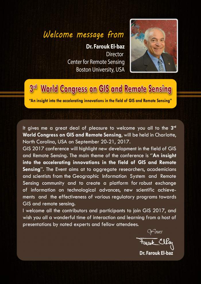
Summary of GIS and Remote Sensing Conference:
GIS and Remote Sensing conference aims to aggregate researchers, academicians and scientists from the Geographic Information System and Remote Sensing community and to create a platform for robust exchange of information on technological advances, new scientific achievements and the effectiveness of various regulatory programs towards GIS and remote sensing. It provides a premier technical forum for reporting and learning about the latest research and development, as well as for launching new applications and technologies. This shows how a GIS in combination with geological data sets can be used to solve specific geological problems. The training on digital image processing focuses on the usage of field and laboratory spectral data to gain a better understanding of Remote Sensing products. Advanced image processing techniques are introduced and applied using Landsat. We welcome all the contributors and participants to join GIS-2017 and it will be a perfect platform to share your research and knowledge with the professionals from all over the world.
Importance and scope:
The field of remote sensing and GIS has become exciting and enchanting with rapidly expanding opportunities. Geographical information system (GIS) is designed to capture, store and manage all types of geographical data. Remote sensing is the accession of information about the object without any physical contact. There are wide range of applications in the field of GIS and remote sensing. Remote sensing also replaces expensive and slow data collection on the ground, ensuring in the process that areas or objects are not disturbed.
GIS and Remote Sensing conference will place a platform where worldwide researchers, academicians and scientists from the Geographic Information System and Remote Sensing community will aggregate to create a platform for robust exchange of information on technological advances, new scientific achievements and the effectiveness of various regulatory programs towards GIS and Remote sensing. It provides a premier technical forum for reporting and learning about the latest research and development, as well as for launching new applications and technologies. It will promote science and technology of the relevant fields of GIS and Remote Sensing
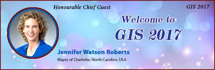
Why Charlotte USA???
Charlotte is the largest city in the state of North Carolina and It is the county seat of Mecklenburg County and the second largest city in the south eastern United States, just behind Jacksonville, Florida. Charlotte is the third fastest growing major city in the United States and metropolitan area of Charlotte ranks 22nd largest in the US and had a 2014 population of 2,380,314. The Charlotte metropolitan area is part of a sixteen-county market region or combined statistical area Charlotte is home to the corporate headquarters of Bank of America and the east coast operations of Wells Fargo, which along with other financial institutions makes it the second largest banking centre in the United States. Among Charlotte's many notable attractions, some of the most popular include the Carolina Panthers of the National Football League (NFL), the Charlotte Hornets of the National Basketball Association (NBA), the Charlotte Independence of the United Soccer League (USL), two NASCAR Sprint Cup races and the NASCAR All-Star Race, the Wells Fargo Championship, the NASCAR Hall of Fame, the Charlotte Ballet, Caro winds amusement park, and the U.S. National White water Centre. Charlotte Douglas International Airport is a major international hub, and was ranked the 23rd busiest airport in the world by passenger traffic in 2013. Charlotte has a humid subtropical climate. The city is located several miles east of the Catawba River and southeast of Lake Norman, the largest man-made lake in North Carolina. Lake Wylie and Mountain Island Lake are two smaller man-made lakes located near the city.
Conference Highlights:
GIS
Remote Sensing
Geo dynamics
GIS Software
Digital Earth
GIS In Mapping
Seismology and Geodesy
Global Navigation Satellite System
GIS in Disaster Management
GIS Market
Members Associated with GIS and Remote Sensing Research:
For the field of GIS and Remote Sensing people are working along with many universities, individual Institutions, associations and societies. Around 450 members in San Antonio, 6000 in USA, More than 8000 physicians, academicians and researchers

Societies & Associations Associated with GIS and Remote Sensing Research:
American Society for Photogrammetry & Remote Sensing
Cartography and geographic information society (CAGIS)
Centre for advanced spatial technologies (CAST)
Centre for spatially integrated social science (CSISS)
Earth sciences & map library, university of California Berkeley library
ESRI conservation program
Federal geographic data committee (FGDC)
Geo community
Geodata alliance
National centre for geographic information and analysis (NCGIA)
National geospatial-intelligence agency (NGA)
Open geospatial consortium (OGC)
Society for conservation GIS (SCGIC)
GIS speciality group
Association for Geographic Information

Industries Associated with GIS and Remote Sensing Research:
3D Laser Mapping
Aarvee associates
Aero-Metric, inc.
AML Solutions Group
Angus Geosolutions Inc. (AGSI)
Avineon India Private Limited
BroadMap
CARIS
Cinco GIS
Complete Spatial Solutions
Datamap
Spatial (Formerly Laser Scan)
http://ecat.giscafe.com/corplist.php

Universities Associated with GIS and Remote Sensing Research in USA:
Acadia University
Alabama A&M University
American Sentinel University
Appalachian State University
Arizona State University
California State Polytechnic University
Central Connecticut State University
Central Washington University
Claremont Graduate University
Delta State University
East Carolina University
George Mason University
Humboldt State University
Indiana University at Pennsylvania
Louisiana Technical University
North Carolina State Universit
San Francisco State University
University of Akron
University of Southern California
http://www.urisa.org/careers/colleges-and-universities/

Target Audience:
Academicians, Research scientists, Students, young researchers, professors from different universities containing GIS and Remote Sensing studies, eminent persons from different associations and societies, directors, CEO’s from different companies.
-
Academia 40%
-
Industry 30%
-
Associations 20%
-
Government 10%
I
Total business of GIS and Remote Sensing market Japan, South Korea, Canada, US, UK, Germany, India, Brazil for the globla geo-services market to be between $ 150 billion and $ 270 billion, chinese government is $ 31 billion.
Funding for GIS and Remote Sensing:

References: 1) http://ecat.giscafe.com/corplist.php
2) http://www.urisa.org/careers/colleges-and-universities/