Biography
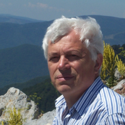
Wachowicz works in the development of spatio-temporal analytical processes based on the discovery and mapping of human mobility behaviour through the synergy between the physical and virtual worlds of Big Data. These analytical reasoning processes that can cope with Big Data are based on interaction, context, and content discovery. Why is this important? Because it is about building the next generation of maps with predictive capabilities for representing the un-mappable "real behaviour" of people in motion in a physical geographical space and their correspondent daily petabyte-scale streams of unstructured data in a virtual world. The greatest challenges and opportunities arise from socially-generated big data, observed as a result of human interactions within a specific context that is increasingly recorded via online transactions, mobile communication devices, and distributed sensors, or revealed through big data at rest. Her main research interests are on advancing the core techniques and technologies in space-time representation, data mining and mobility analytics to lead to new fields of inquiry and encourage ambient and living cartography.
Research Interest
GIS, Big data, Geography, Remote Sensing
Biography
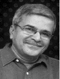
Mukesh Singh Boori is Senior Scientist in Samara University Russia (03/2015–Present, funded by Russian Federation), Visiting Professor in JKLU University India (10/2016-11/2016), Visiting Senior Scientist at University of Bonn, Germany (05/2016–07/2016), Visiting Scientist/Professor at Hokkaido University Japan (12/2015–02/2016) and Adjunct Professor in American Sentinel University Colorado USA (07/2015–Present). He was involved in European Union Project as well as Visiting Assistant Professor in Palacky University Olomouc, Czech Republic (04/2013–06/2015), Ruhr University Bochum Germany (09/2014–12/2014) and University of Leicester, UK (Honorary Fellow 2014) funded by European Union; at the same time he was Assistant Professor in JECRC University India (01/2013–06/2015). He was Scientist in Satellite Climate Studies Branch (NOAA/NASA) selected by National Research Council (NRC) Central Govt. of USA Washington DC. During that time he completed his Postdoc from University of Maryland USA (10/2012). He has done PhD (EIA & Management of Natural Resources) from Federal University – RN (UFRN) Natal –RN Brazil (08/2011) funded by Brazil–Italy Govt. fellowship. He has done Predoc (Earth & Environmental Science) from Katholieke University Leuven Belgium (08/2008) selected by Ministry of Human Resource Development (MHRD) New Delhi India and funded by Govt. of Belgium. He has done MSc (Remote sensing & GIS) from MDS University Ajmer (2004) and BSc (Bio-group) from University of Rajasthan Jaipur India (2002). In early career he was scientist in JSAC/ISRO (2006-2007) and before that Lecturer (PG) at MDS University Ajmer (2005-2007Sessions). He received international awards/fellowships from UK, USA, Brazil, Italy, Indonesia, Belgium, Czech Republic, Germany, Russia, China, Japan and India. He known Six Language and visit four Continents for Awards, Meetings, Trainings, Field Trips, Seminars and Conferences. He is an active Organizing Committee Member in Earth & Space Science Conferences, Co-Chaired a session and gave Conference Opening Ceremony Speech as Reynold Speaker (08/2012) at Chicago USA. He is editor and member of more than 10 International Scientific Societies/Journals/Committees related to Earth & Space Science; which include organize conferences. His prime research interest is “EIA and Management of Natural Resources through Remote Sensing & GIS Technologyâ€. He has more than 100 Peer-reviewed International Publications including Books as a first author on Vulnerability, Risk Assessment and Climate Change.
Research Interest
Remote Sensing & GIS, Vulnerability & Risk Assessment, Digital Image Processing, Thermal & Microwave remote sensing, Satellite Generate Brightness Temperature, Earth Observation, Land Use/Cover Change Trajectories, Geoscience/Geo-informatics, Bio-Geography, Biodiversity, Hydrology, Climate Change, Environmental Impact Assessment, Management of Natural Resources, Land Resources Management, Sustainable Development & Disaster Management, Remote Sensing Applications in: Forest, Agriculture, Ecosystem, Ecology, Urban & Desert Study


